CHARMAINE CRUZ completed her BSc and MSc degrees in Geomatics Engineering from the University of the Philippines Diliman, Philippines. She worked on the iHabiMap project, funded by the Environmental Protection Agency (EPA), as a Ph.D. student. Her research interests include the use of geospatial technologies in natural resources management (e.g., habitat distribution mapping, biomass mapping), environment, and climate change-related studies in support of conservation and sustainable development initiatives.
She spoke to Silicon Republic back in 2020.
Why did you become a researcher?
My interest in research started when I received an opportunity to be involved in a LiDAR mapping project in the Philippines in 2012. At that time, in the Philippines, LiDAR was quite a new technology. This enabled me to explore beyond what I had been taught in college. I was incredibly fortunate to have excellent mentors to guide me in my research experience. During my seven-year involvement in research projects in the Philippines, I have found myself passionate about two things: science and the environment. My research focuses on doing science to enhance environmental protection. I am very interested in using geospatial technologies, such as Geographical Information Systems (GIS) and Remote Sensing for natural resource management (e.g., mapping habitat distribution and biomass as well as habitat condition). I am also interested in the environment and climate change-related studies that support conservation and sustainable development initiatives.
I love doing research and I get excited when I learn new ideas and methods and when they yield new insights. Also, I really enjoy the extra things that come with research, such as being in the field (or ocean) to collect my data, attending conferences where I can learn about the work of other researchers, as well as present my research, and also collaborating with researchers who share similar interests as mine.
Can you describe your research right now?
I’m in the first year of my Ph.D. research and am working on a remote sensing project called “Habitat Mapping, Monitoring and Assessment using High-Resolution Imagery” or iHabiMap (twitter: @iHabiMap). It is a multidisciplinary project that is developing analytical approaches to determine if images acquired by Unmanned Aerial Vehicles (UAVs) can be analyzed using machine learning techniques to effectively map, monitor and assess three types of Irish habitats – uplands, grasslands, and coastal. I’m working together with a great team consisting of experts from remote sensing, machine learning, ecology and geography. This project is for four years and is funded by the Environmental Protection Agency (EPA), Ireland.
This summer, we have an extensive field campaign. We are collecting UAV images and ecological field data at five study sites throughout Ireland. We will collect data at the same site several times to capture the inter-seasonal and inter-annual variability of the habitats. One of our sites is a grassland site. It is very dynamic and varies widely within a growing season (i.e., April to September). It is necessary that we start recording at this site early in the year and continue until close to the end of the growing season. This could help us to accurately and effectively classify the vegetation and vegetation dynamics on site.
What’s the wider significance of your research?
In my opinion, my current research is important because it has the potential to be used in effective mapping and monitoring the environment. This is particularly useful because Ireland, as part of the European Union, is required to conduct assessments of ecosystems and to report the conservation status of its habitats to the European Commission every six years. Delivering this report is a huge task for a periodic national assessment if only field-based collected data is the source of information. So there is a need for another approach that could complement effectively with the existing habitat mapping and monitoring efforts.
What other applications do you foresee for your research?
This is an EPA funded project that aims to help agencies in Ireland to develop more accurate estimates of the state of our environment and how well various habitats are doing in terms of the Habitats Directive. However, it can be used in commercial applications such as mapping of invasive species for targeted control and eradication, assessment of coastal defense systems and natural disaster management.
What are the challenges of your research?
There are numerous challenges to environmental research. These include:
What future research you like to undertake?
I am keen and enthusiastic about my current research field because I am passionate about environmental protection. I also enjoy spending my free-time surrounded by nature. I would also love to focus on solution-oriented works, rather than just being research-oriented. Solution-oriented research will allow me to address the pressing environmental issues of our times by providing my community with science-based information that is needed for effective mitigation, protection, and sustainable utilisation of our natural resources and environment. I would like to pursue a project that will focus on environmental monitoring and protection in mitigating climate change. The budget will be intended for launching new satellites that can acquire daily centimetre-level images. This technology will be so much interesting for remote sensing scientists!
Who is your professional idol?
My mentors in the Philippines, particularly Dr. Ariel Blanco, Dr. Enrico Paringit and Engr. Ayin Tamondong. Throughout my education and my research career, I have had professors and project leaders who have supported and challenged me to be my best. They are well-respected professors at the University of the Philippines and top researchers in the Philippines’ Department of Science and Technology. Without their dedication and passion for teaching and training students and young researchers, I probably would not be where I am right now and would not have taken the path I did.
Who is your personal idol?
My personal idol is my aunt Ellen. She supported my education since grade school until I received my college degree. I cannot imagine myself reaching my dreams without her. Her unconditional love for me and for everyone surrounding her is outstanding!
What is your favourite pastime?
I have three – going out into nature, connecting with friends/family especially now that I am living far from them, and playing my ukulele.
What three objects would you take from a burning building?
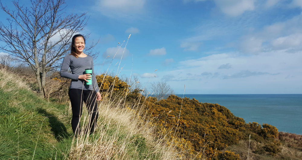
My green tumbler (which is always with me everywhere I go), my laptop, and the external hard drives where my Ph.D. files are stored
What task are you consistently terrible at?
Cooking! My mom used to cook and prepare my food until I moved out of my country to study for my Ph.D. here in Ireland.
What’s the hardest thing about working from home?
Having a physical space that is solely designated for working. It is the hardest thing for me because I am living with six other people. I ended up having to work in my room, which is not conducive as it is also my space for resting.